(3 votes, average: 3.67 out of 5)
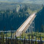
The Puente de Ojuela is a suspension bridge in Mexico that is 1031.3 feet (318 meters) long and 5.91 feet (1.8 meters) wide. It was built in 1898 and is now a popular tourist destination. The bridge is located in a remote area, and the road leading to it is narrow and winding. The bridge offers stunning views of the surrounding landscape and is a great place to go hiking, biking, or simply enjoy the scenery.
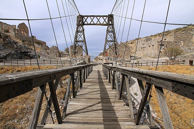
The bridge is located in Mapimí, in the state of Durango. The bridge is nestled between two impressive hills and crosses an ravine of almost 328 feet (100 meters) deep. The bridge is considered a majestic engineering work of the time. The original bridge remains, with two wooden towers, although the original cable was replaced by steel cables for safety. The surroundings are spectacular, reaching the old Ojuela settlement, which today is a ghost town.
Ojuela Bridge Road
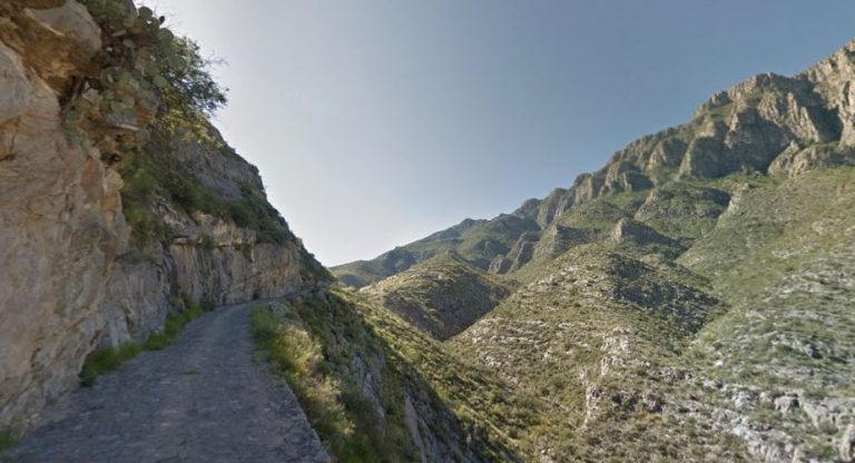
Although this bridge is currently only used for pedestrians, the road that leads to it is spectacular and difficult. It is one of the most terrifying and mysterious bridges in the world. Located in an impressive arid landscape of desert colors and rock formations, the road is paved with cobblestones and gravel. It is extremely narrow, so it is not recommended to drive it to those who do not know how to drive in reverse, as in case the entire journey only fits one car, and there is no safety railing, so the danger is maximum. The road to the bridge is about 10 kilometers long.

History of the Ojuela Bridge
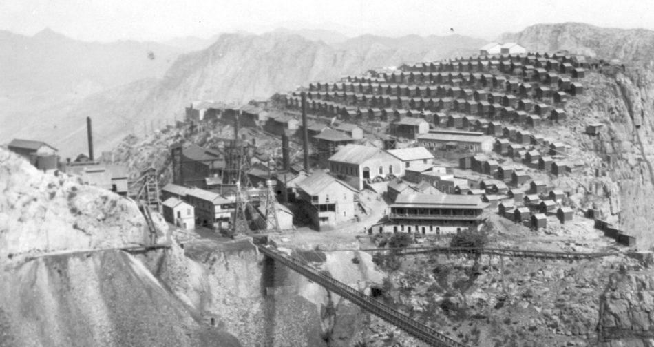
The bridge dates back to 1898 and was restored as a tourist attraction in 1991. For centuries it served as a passage for the workers of the old Ojuela mine (15 minutes from Mapimí), a settlement created for the use of the workers of said mine. The mine was discovered by the Spaniards around 1600 and was abandoned in the 1950s.
How to get to the Ojuela Bridge, location map
The bridge is reached by the winding road mentioned above, which is accessed through the small town of Mapimí. There are different ways to access Mapimí: from the south, if you are coming from Durango (300 kilometers and about 3 hours by car), you have to take the 40D to Gómez Palacio and continue in the direction of Bermejillo, which is only 25 kilometers from Mapimí. From the north, if you are traveling from Chihuahua (440 kilometers, 5 hours), you have to take the 45D to Jiménez and then the 49D that arrives to Bermejillo. From Bermejillo, you have to turn left before reaching Mapimí and take the 10-kilometer road that leads to the bridge.
The following map shows the exact location of the Ojuela Bridge
Version en Español: Puente de Ojuela, Durango, México