(4 votes, average: 4.75 out of 5)
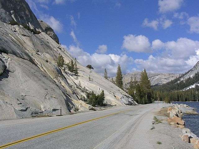
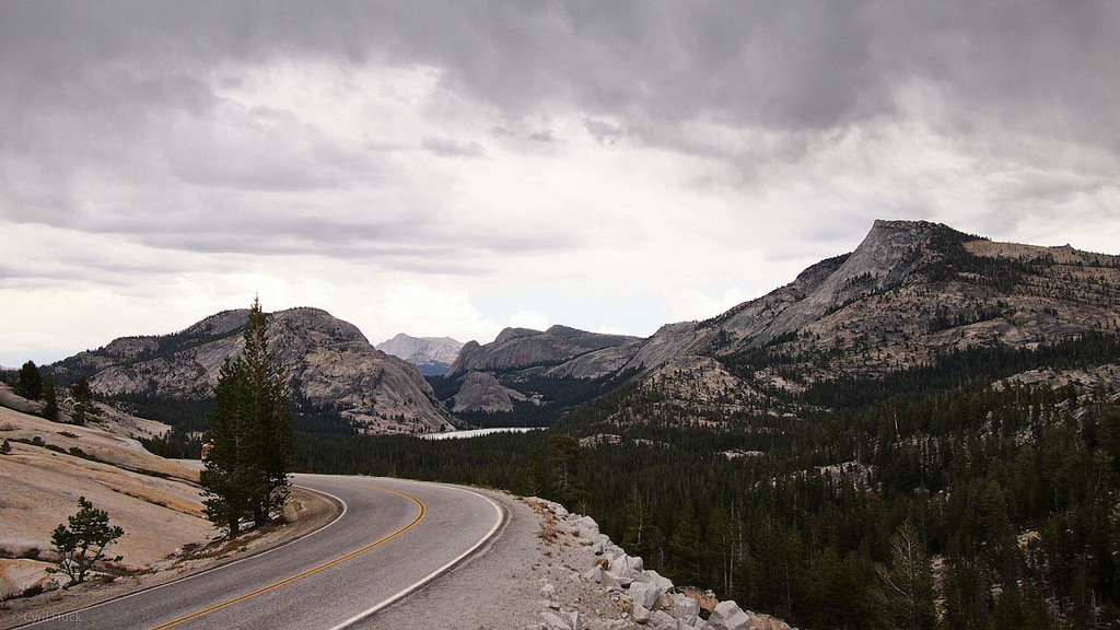
Tioga Pass is a 9,945 feet (3,031 meters) mountain pass located in the Sierra Nevada mountains in California, United States. It is located in Yosemite National Park, in Mono County. The road is 39 miles (63 km) long and begins at Crane Flat, passing through Olmsted Point, Tenaya Lake, and Tuolumne Meadows before reaching the summit.
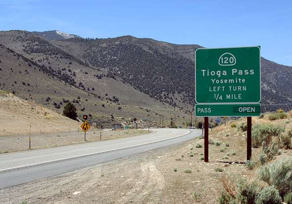
Tioga Pass is the highest point on California State Route 120 and is one of the highest mountain roads in California. The road to Tioga Pass is located about 25 miles (40 km) from the town of Mammoth Lakes and is a popular tourist destination, offering stunning views of the Sierra Nevada mountains. It is known for being a popular destination for hiking, mountain biking, and fishing.
When does Tioga Pass open?
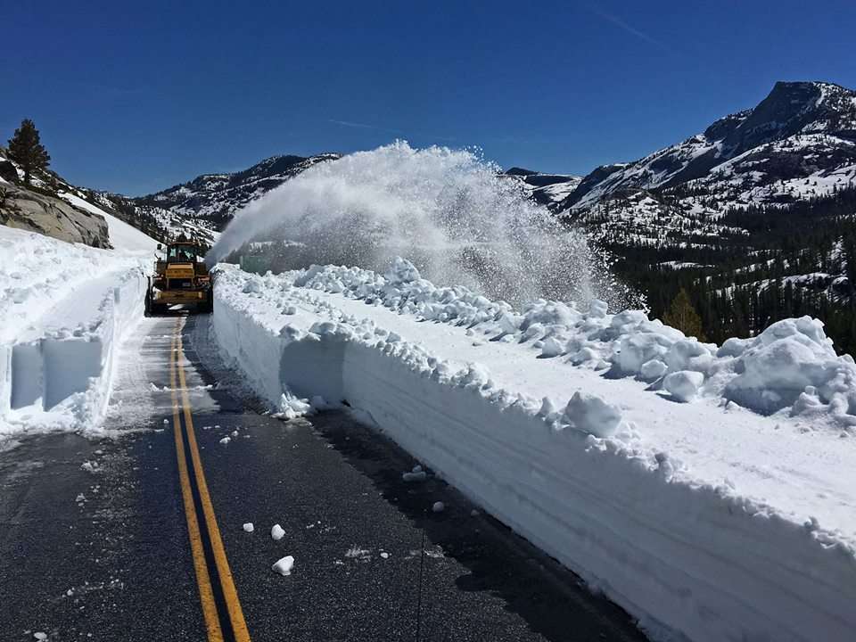
The pass is open to all vehicles in the spring and summer and closed in the fall and winter. In years with heavy snowfall, the road closes in early October and has opened as late as mid-July. In years with light snowfall, the road may stay open until December and open in April. The most recent opening dates can be seen on the official Yosemite website.
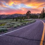
The weather in this area is harsh and unpredictable, and it can go from sunny to snowy in a matter of minutes. The road has a well-deserved reputation for being dangerous due to unpredictable snow storms, and driving under these conditions can be dangerous. Tioga Pass is a scenic drive through forests, meadows, lakes, and granite rock formations. The scenery is spectacular and exciting
How is the road to Tioga Pass?
Starting from Lee Vining, the climb is 12.4 miles (20 km) long and the elevation gain is almost 3,000 feet (914 m). The average grade is 4.7%. The pass is the eastern boundary of Yosemite National Park and provides instant access to the spectacular Sierra Nevada with classic climbs that can be easily done in a day. There are several Yosemite trails that start at Tioga Pass, including the trail to Gaylor Lakes and the route to the summit of Mount Dana.
What to see and do near Tioga Pass?
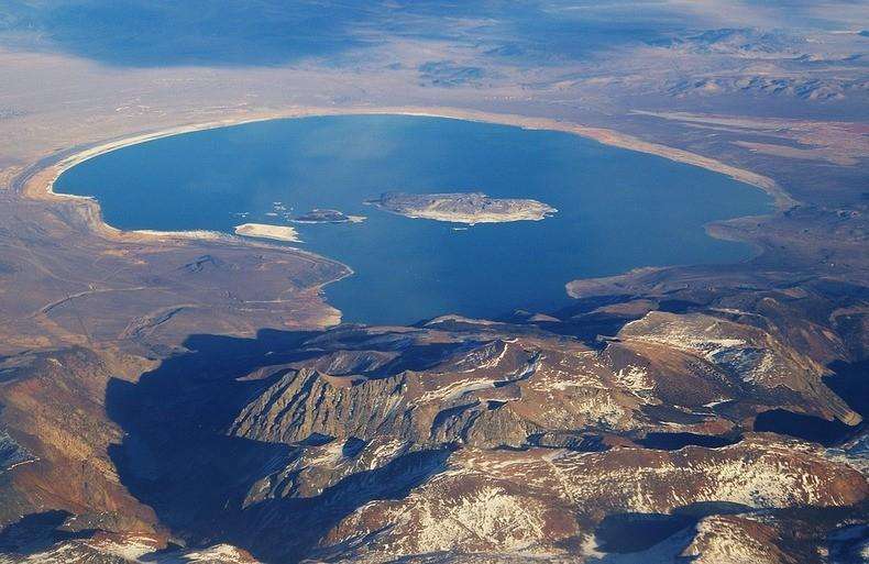
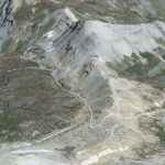
Mono Lake Aerial View at the Tioga Pass
- The road passes by spectacular lakes: Tenaya Lake, Ellery Lake and Mono Lake. Fishing is allowed in these lakes.
- If you are a hiking enthusiast, the road crosses directly over the famous Pacific Crest Trail. There are other interesting hikes in the area such as the Clouds Rest Trail, the Tenaya Lake Trail or the Tuolumne Meadows Trail.
- There are many camping areas with views located along the route. Some of the most popular are Tuolumne Meadows Campground, Crane Flat Campground and White Wolf Campground.
- The road passes through Tuolumne Meadows, one of the most famous attractions in Yosemite.
- Enjoy some of the best views in the Sierras from Olmstead Point.
Tioga Pass Map
Helpful links to enjoy Yosemite
There are more than 40 types of accommodation in the area around Tioga Pass.
You can find cheap flights to California on Kayak.
You can also rent a car if you need a vehicle.
When to go
The best time to visit Tioga Pass is during the summer months (June-August). The weather is mild during this time, and the pass is open to traffic. However, it is important to note that Tioga Pass can be very crowded during the summer months, so it is best to arrive early in the day or late at night.
If you are planning to visit Tioga Pass during the spring or fall, be sure to check the weather forecast before you go. The weather in the Sierra Nevada mountains can change quickly, so it is important to be prepared for all types of conditions.
History
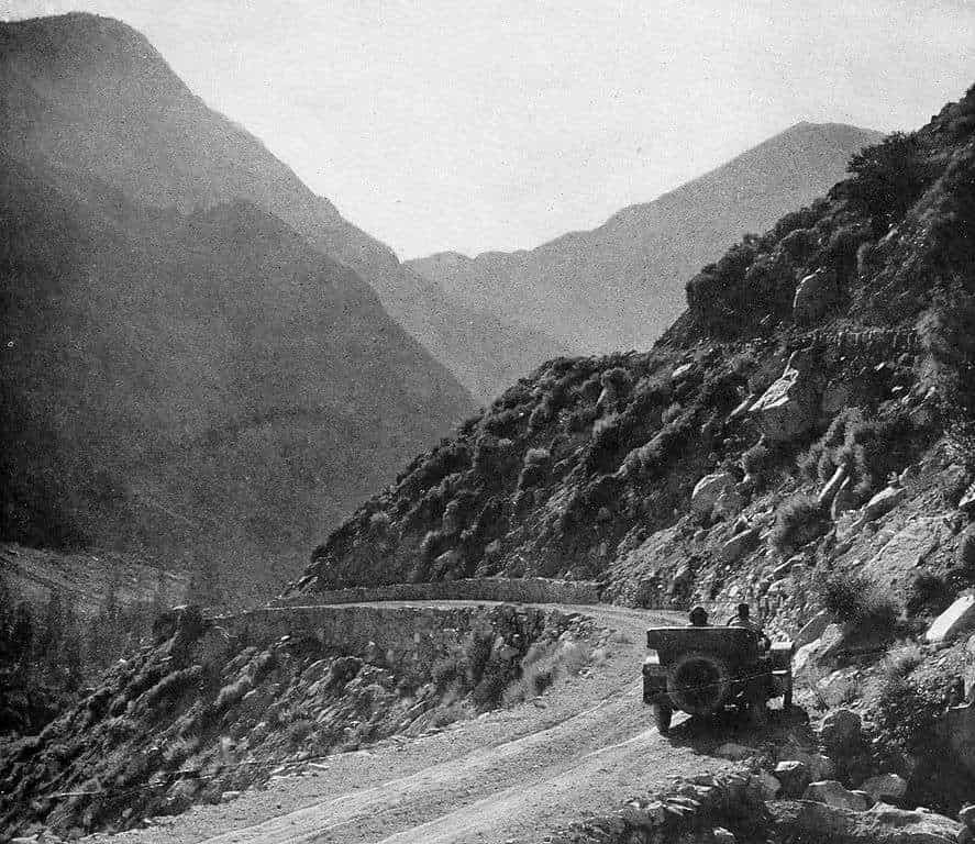
The name Tioga Pass comes from the Tioga silver mines, its origin is Iroquois (Native American people who emerged around the Great Lakes region) and means “place of the fork”. The pass was already used by the natives for centuries and was discovered by the settlers in 1850 becoming an important route for trade and transportation.
In the 1880s a wagon route was built for the transport of food and supplies to the silver mines. In 1915, the United States government built a road that was modernized and paved in the 1960s and over the years has become a place of pilgrimage for travelers and adventurers.