(3 votes, average: 4.67 out of 5)
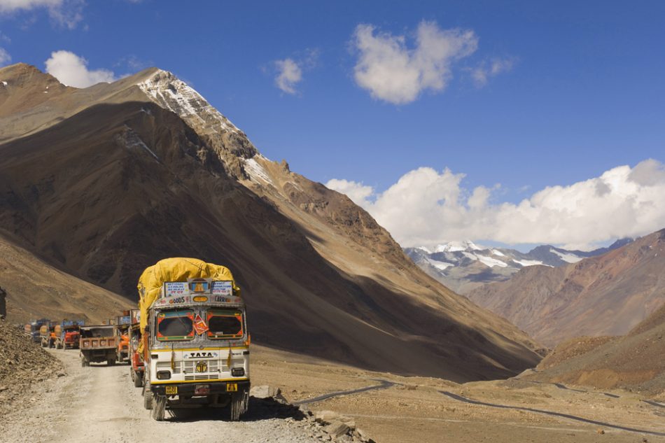
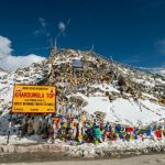
Baralacha La Pass is located in the Zanskar range of the Himalayas in the Indian state of Himachal Pradesh. It’s a high mountain pass in Ladakh with an elevation of around 4,875 meters (16,040 feet) above sea level. The pass connects the Lahaul and Spiti valleys in the north with the Kinnaur valley in the south and is a popular destination for travelers and tourists due to its stunning views of the surrounding mountains and valleys.
| Name | Baralacha La Pass |
| Elevation | 4,875 meters (16,040 feet) |
| Main Road | Manali Leh Highway |
| Country | India |
| Mountain Range | Himalaya, Pir Panjal y Zanskar |
| Coordinates | 32°44′N 77°26′E |
The pass is a major route for both motor vehicles and trekkers, and it is typically open from June to October each year, depending on weather conditions. During the rest of the year, the pass is usually closed due to heavy snowfall. It is known for its steep and winding roads, which offer stunning views of the surrounding mountain ranges.
When it’s open Baralacha La
During the winter months, the pass is covered in snow and is often closed due to harsh weather conditions. It is also home to a number of high-altitude lakes, including Suraj Tal and Deepak Tal, which are popular destinations for trekkers.
Baralacha La Pass is located in a remote and sparsely populated region of the Himalayas, surrounded by some of the highest peaks in the world, including the Bhagirathi peaks and the Satopanth peak. It’s also home to endangered species like the snow leopard, ibex, and blue sheep.
Drive and Permits in Baralacha La
The road to Baralacha La is narrow and winding with sharp drops and steep inclines. It’s also prone to landslides, especially during the monsoon season. To safely navigate the pass, it’s recommended to have a four-wheel drive vehicle with good clearance and strong brakes.
You do not need a special permit to cross Baralacha La, but it is important to be properly prepared for the journey. Make sure you have adequate supplies of food, water, and other essentials, as well as warm clothing and other equipment for the high altitude. It is also advisable to travel with a group and to inform someone of your travel plans.
Baralacha La Pass is one of the highest passes in Ladakh, located about 70 kilometers from the town of Keylong. Drivers traveling from Manali to Leh by car must pass through this pass. If you are going from Manali to Leh by Car, it’s best to cross the pass before noon. The high altitude of this pass causes snow to melt and form water streams, making it harder to cross as the day goes on. If the current is too strong, people may have to turn back to Jispa, as the water can be dangerous to cross.
A few kilometers from the Baralacha La pass towards Manali flows the Bhaga River, a tributary of the Chandrabhaga, which comes from the Surya Taal lake, that is almost 5,000 meters high. This pass is the starting point for several popular trekkings among tourists visiting this area of India: the famous Suraj Tal and Chandra Tal trek.