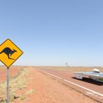
In the heart of the Australian Outback lies the rugged and remote Gunbarrel Highway, a legendary route that offers intrepid travelers a glimpse into the country’s vast and untamed interior. Stretching across the desolate landscapes of Western Australia and the Northern Territory, this iconic road is steeped in history and adventure, making it a must-visit destination for those seeking an unforgettable journey through the Australian wilderness.
| Country | Australia |
| Location | Carnegie Station in Western Australia to Victory Downs in the Northern Territory |
| Length | 1,400 kilometers (870 miles) |

Pic By: Dirks Backyard (www.exploroz.com)
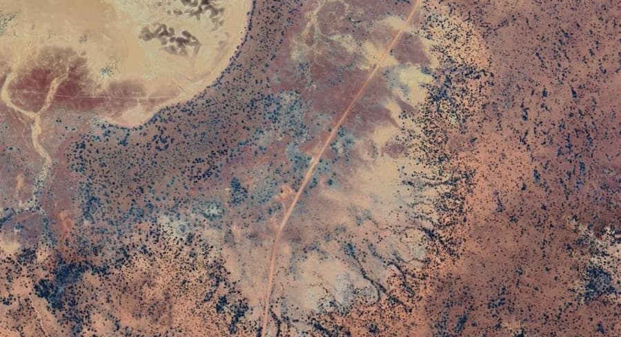
Spanning approximately 1,400 kilometers (870 miles), the Gunbarrel Highway winds its way from Carnegie Station in Western Australia to Victory Downs in the Northern Territory. Along the way, it passes through some of the most isolated and desolate landscapes in the country, connecting travelers with a handful of remote outback settlements and Aboriginal communities. Key cities and towns along the route include Warburton, Giles, and Docker River, each offering a unique glimpse into Outback life and culture.
Gunbarrel Highway Map
History and Origins

Road Sign marking the boundary of Victory Downs station, the beginning of the original Gunbarrel Highway. Author Summerdrought
The Gunbarrel Highway traces its origins back to the 1950s when legendary surveyor Len Beadell led a team of workers in the construction of this remote outback road. Named after the Gunbarrel Road Construction Party, the highway was initially built as a supply route for the nearby atomic testing sites during the Cold War era. Despite its humble beginnings, the Gunbarrel Highway soon became a vital lifeline for travelers and adventurers seeking to traverse the remote regions of central Australia.
Exploring the Outback
Traveling along the Gunbarrel Highway offers adventurers a chance to experience the raw beauty and untamed wilderness of the Australian Outback. From vast deserts and rugged mountain ranges to ancient Aboriginal rock art sites and hidden waterholes, the highway is dotted with unique attractions and natural wonders waiting to be discovered. Highlights along the route include:
- Giles Weather Station: Located near the midpoint of the highway, Giles offers travelers a chance to rest and refuel while learning about the region’s weather and climate monitoring efforts.
- Warakurna Roadhouse: Situated in the heart of the Gibson Desert, Warakurna Roadhouse serves as a welcome oasis for weary travelers, offering fuel, supplies, and accommodation in the midst of the outback wilderness.
- Everard Ranges: Towering over the desert landscape, the Everard Ranges provide a stunning backdrop for travelers as they make their way along the Gunbarrel Highway, offering ample opportunities for hiking, photography, and wildlife spotting.
- Lake Carnegie: Nestled amidst the arid plains of Western Australia, Lake Carnegie is a vast salt lake that serves as a vital watering hole for wildlife and a popular stopover for travelers exploring the Outback.
Driving the Gunbarrel Highway
Travelers must be prepared for long stretches of rough, corrugated roads, extreme temperatures, and limited access to supplies and services. Additionally, the highway can become impassable during periods of heavy rain or flooding, making careful planning and preparation essential for a safe and enjoyable journey.
Driving along the Gunbarrel Highway is a true test of skill and endurance, requiring patience, perseverance, and a sense of adventure. Travelers should ensure their vehicles are well-maintained and equipped with all the necessary supplies and equipment for a remote outback journey, including spare tires, plenty of water, and emergency communication devices. It’s also important to observe speed limits, drive cautiously, and be respectful of the fragile desert environment and its indigenous inhabitants.
Facts and Trivia
- The Gunbarrel Highway was named after the Gunbarrel Road Construction Party, a group of workers who built the road in the 1950s.
- The highway passes through some of the most remote and uninhabited regions of Australia, with long stretches of road between fuel stops and settlements.
- The Gunbarrel Highway is not a maintained or graded road and can be rough, corrugated, and prone to washouts and flooding, especially during the rainy season.
Gunbarrel Highway Itinerary: A 7-Day Adventure
Disclaimer: This is a sample itinerary and may need adjustments based on your specific interests, pace, and road conditions. Remember, the Gunbarrel Highway is a challenging and remote track, requiring thorough preparation and responsible travel practices.
Day 1:
- Start: Wiluna, Western Australia, nearest town with supplies. The Wiluna Carnegie Road somtimes is considered a part of the Gunbarrel Highway
- Distance: 270 km
- Activities: Stock up on supplies in Wiluna, visit the Wiluna Heritage Museum, fuel up your vehicle, obtain your permit (if needed)
- Accommodation: Camping at Wiluna Roadhouse or nearby
Day 2:
- Distance: 230 km
- Activities: Enter the Gibson Desert, drive through Meentharra Creek, visit Giles Weather Station (the oldest operating weather station in Central Australia), camp under the stars.
- Accommodation: Camping near Giles Weather Station
Day 3:
- Distance: 200 km
- Activities: Visit Mount Beadell and its lookout point for panoramic desert views, explore the Docker River community (with permission from the Traditional Owners), learn about the Martu people’s culture.
- Accommodation: Camping near Docker River or continue to Tjukutja Roadhouse (limited supplies)
Day 4:
- Distance: 160 km
- Activities: Explore the scenic Carnegie Creek, visit the historic Carnegie Station (check opening hours), climb the Carnegie Hill for sweeping views.
- Accommodation: Camping near Carnegie Station or continue to Well 33 (camping with basic facilities)
Day 5:
- Distance: 200 km
- Activities: Visit Lasseter’s Cave (where gold prospector Harold Lasseter claimed to find gold), explore the surrounding rock formations, enjoy the desert sunset.
- Accommodation: Camping near Lasseter’s Cave or continue to the turnoff for the Canning Stock Route (camping with limited facilities
Day 6:
- Distance: 200 km (variable depending on chosen route)
- Activities: Choose your route:
- Continue on the Gunbarrel Highway: Explore the scenic Granite Range, visit the abandoned Kulgara gold mine, marvel at the vastness of the desert.
- Take the Canning Stock Route detour: Visit some of the original wells and watering points, experience the unique history of this iconic route.
- Accommodation: Camping along the chosen route (limited facilities)
Day 7:
- Distance: 200 km
- Activities: Drive back to Wiluna, reflect on your outback adventure, top up your fuel and supplies before departing.
- Accommodation: Wiluna Roadhouse or nearby
Additional Notes
- This itinerary assumes you have a high-clearance 4WD vehicle and are traveling in a convoy.
- Be sure to check the road conditions before you go, as they can change quickly.
- Carry plenty of water, food, fuel, and spare parts.
- Be aware of the dangers of the desert, such as extreme heat, flash floods, and wild animals.
- Respect the environment and leave no trace.
- Remember, this is just a suggestion, and you can tailor it to your own interests and preferences. The Gunbarrel Highway is an unforgettable experience, so enjoy the journey!
In conclusion, the Gunbarrel Highway offers travelers a chance to experience the rugged beauty and isolation of the Australian Outback, providing a journey unlike any other. Whether you’re a seasoned adventurer or a first-time visitor, exploring this iconic outback highway promises an unforgettable adventure filled with stunning landscapes, unique attractions, and the freedom of the open road. So pack your bags, fuel up your vehicle, and get ready to embark on an epic journey through the heart of the Australian Outback along the Gunbarrel Highway.